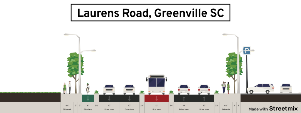
Today’s class we explored several different programs for to generate graphics useful for the planning profession. Expanding upon last week’s class we had a discussion of GIS programs in particular the the ESRI software suite including ArcGIS Pro, Urban Footprint, CityCAD, and various graphic tools (GIMP, InDesign, Photoshop). One program we discussed was SketchUp as there is an urban planning plugin for the program and I have had a lot of experience with the program from my undergraduate education in architecture. The professor mentioned he would show us how to access the program for free (it used to be free prior to getting bought up by Trimble). I am looking forward to getting back into that program. Additionally, we were given an assignment to modify an existing street in Greenville to make it more palatable for pedestrian and vehicular use (putting the street on a diet). I actually have been having a lot of fun with this assignment as we have been able to use an online tool called StreetMix to reimagine the streetscape on Laurens Road. The tool is both fun to mess around with and a really intriguing graphical tool. We are then going to make a one page flyer showing the current condition of the street and the proposed “diet” streetscape using Adobe’s InDesign, another program I am familiar with. I am very much looking forward to completing this assignment.